From Peaks to Precipitation: Topography’s influence on rainfall

Abstract

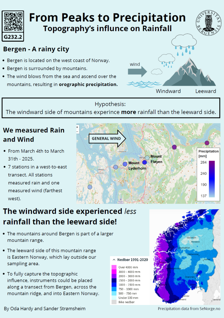
Orographic precipitation, driven by the forced ascent of moist air over mountainous terrain, plays a major role in shaping regional climates. Bergen, Norway, located between the North Sea to the west and steep mountains to the east, is known for its consistently high rainfall.

In this study, we investigated how the mountainous terrain surrounding Bergen modulates rainfall intensity and distribution. Precipitation measurements were collected along a west-to-east transect from Sotra to Trengereid, using seven HOBO rain gauges. Wind measurements were conducted at Sotra using a Wind logger, to monitor wind directions during the study period.

Our cumulative results identified two distinct rainy periods, from March 5–10 and March 23–30, 2025. Analysis indicated a clear precipitation gradient, with rainfall increasing by approximately 73% from the west coast inland toward Trengereid. During these events, prevailing winds were predominantly southerly to south-easterly.

The results show the connection between the moist air from the sea being forced over the mountainous terrain and the precipitation levels in the area. These results not only help explain Bergen’s famously wet climate, but also provide insights into broader patterns affecting coastal mountainous regions worldwide.

Screenshot of the poster entitled From Peaks to Precipitation Topography’s influence on Rainfall

Poster number:

G232.2

Authors:

Oda Kristina Krogh Hardy
& Sander Strømsheim

GEOF232 - Spring 2025

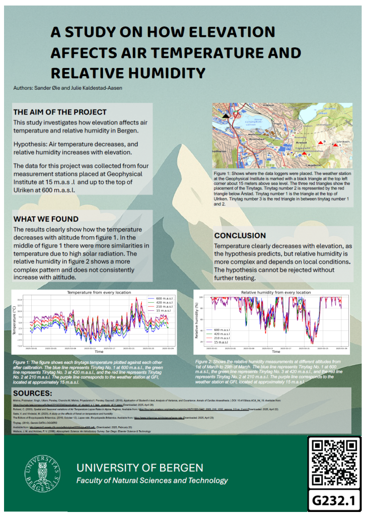
A study on how elevation affects air temperature and relative humidity

Abstract

This study investigates the effects of elevation on air temperature and relative humidity in Bergen, Norway. The primary hypothesis is that temperature decreases and relative humidity increases with altitude, in accordance with the atmospheric lapse rate. Data was collected between February 28 and March 29, 2025, using three Tinytag loggers and an Automatic Weather Station positioned at four elevations ranging from 15 to 600 meters above sea level. The collected data included temperature, relative humidity and dew point. Linear regression and a statistical test were used to analyze the data. The results show a clear decrease in temperature with increasing elevation, supporting the lapse rate theory. The trend in relative humidity was less consistent, and the results did not support the hypothesis. However statistical analysis suggests that the observed variations are likely due to random factors rather than a true effect of elevation. This means the hypothesis cannot be dismissed without further testing. Local topography and environmental factors, such as vegetation and terrain, are identified as possible influences on the data. Overall, the study confirms a negative correlation between temperature and elevation, while the relative humidity is more complicated. This research provides valuable insights into vertical atmospheric gradients, contributing to a better understanding of how local environmental factors affect temperature and humidity profiles.

Screenshot of the poster entitled A STUDY ON HOW ELEVATION
AFFECTS AIR TEMPERATURE AND
RELATIVE HUMIDITY

Poster number:

G232.1

Authors:

Julie Kaldestad-Aasen
& Sander Øie

GEOF232 - Spring 2025